2013.049.428
Blueprint
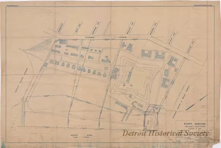
Fort Wayne, Detroit, Michigan -
Survey of 1927
One blueprint drawing (and one sepia print) entitled "Fort Wayne, Detroit, Michigan - Survey of 1927." The drawing (sheet 1 of 1) shows a general layout of the fort property and buildings as well as adjacent streets and property owners. Boundary lines and reference lines are shown on the fort property along with bearings and distances. Several handwritten pencil sketches and notes are shown at various locations on the sheet. A title block in the lower right corner shows that the survey drawing was prepared by the "U. S. Lake Survey Office, Detroit, Michigan," at a scale of 1 inch = 100 feet and is dated October 6, 1927." The survey was signed by "F. G. Ray, Senior Engineer," and G. B. Pillsbury, Lieut. Colonel, Corps of Engineers."
Request Image

