2013.049.116
Blueprint
Historic Fort Wayne
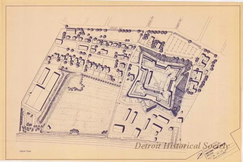
One blueprint site plan entitled "Historic Fort Wayne." The plan shows an overall view of the grounds of Fort Wayne including the fort walls, adjacent buildings, roads, parking areas, and the Army Corps of Engineers boat yard. Jefferson Avenue, Livernois Avenue, Dragoon Avenue, and the Detroit River are shown outside the fort grounds. The title block in the lower right corner indicates that the site plan was prepared by the City of Detroit Historical Department. It was drawn by "JEC [James E. Conway]" and "CTM" at a scale of 1 inch = 100 feet and is dated June, 1988.
Request Image


