Map
Antoine LaMothe Cadillac's Journey from Montreal to Detroit
One set of five computer printout maps that trace Cadillac's journey from Montreal to Detroit in 1701 and 1703, as prepared by Larry M. Wyckoff, 2018. The maps are printed in black, blue, and red ink on white paper. Map titles and descriptions are listed as follows:
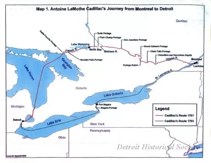
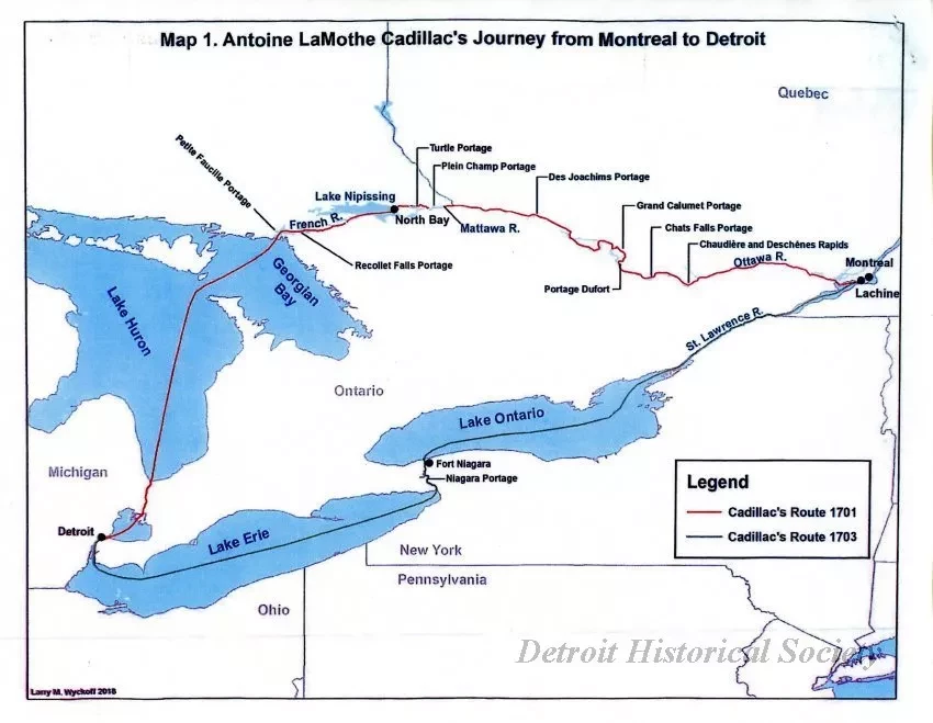
Map 1.
"Antoine LaMothe Cadillac's Journey from Montreal to Detroit."
His 1701 journey (northern route) is shown in a red line and his 1703 journey (southern route) is shown in a black line.
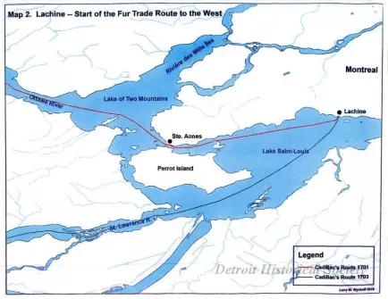
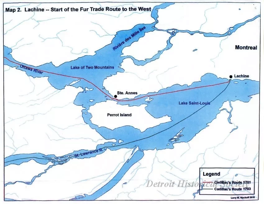
Map 2.
"Lachine - Start of the Fur Trade Route to the West."
This enlarged map shows the different directions taken by Cadillac from Lachine to Detroit in 1701 (via the Ottawa River) and 1703 (via the St. Lawrence River).
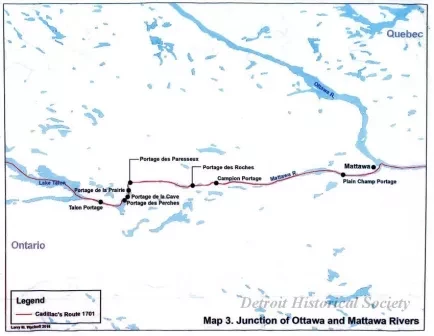
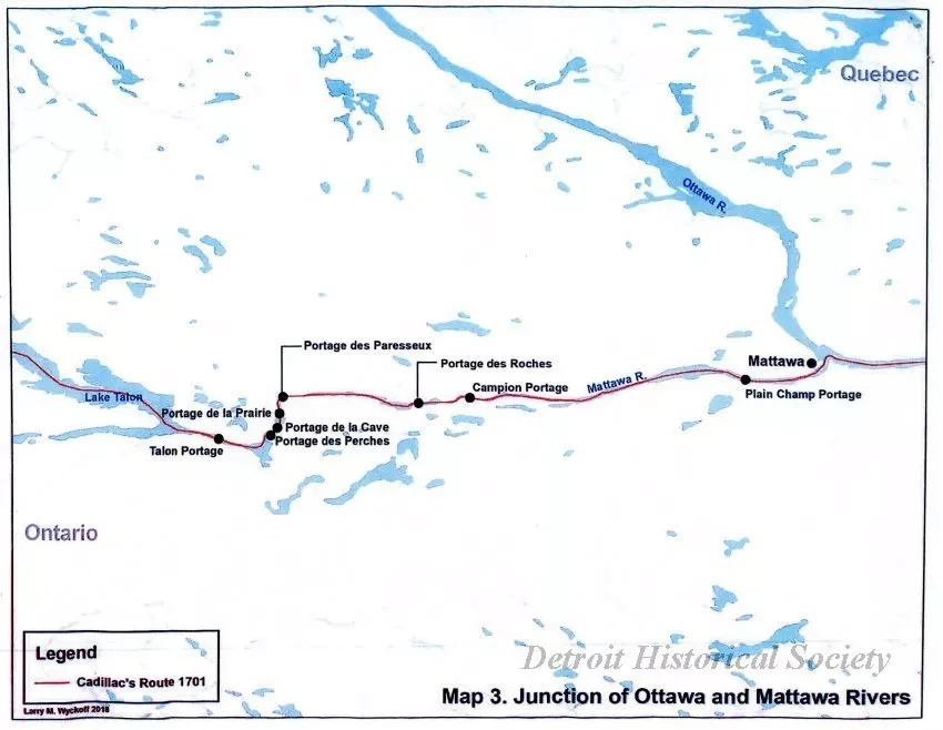
Map 3.
"Junction of Ottawa and Mattawa Rivers."
This enlarged map shows the 1701 route in greater detail from Mattawa to Lake Talon.
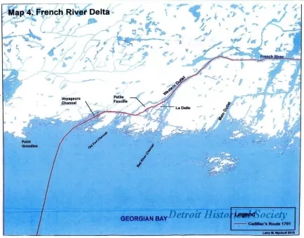
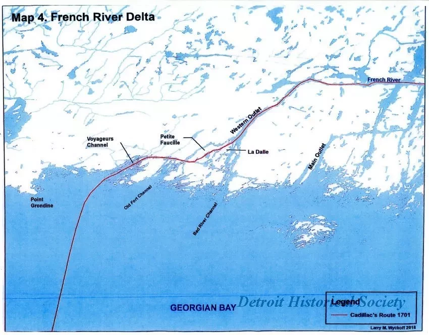
Map 4.
"French River Delta."
This enlarged map shows the 1701 route from the French River to Georgian Bay.
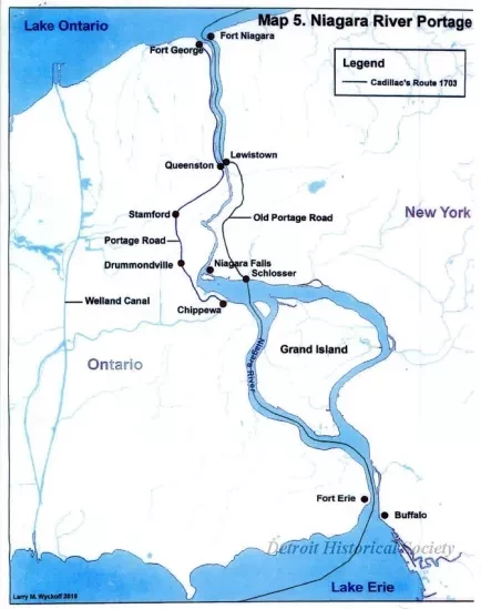
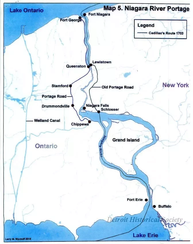
Map 5.
"Niagara River Portage."
This enlarge map shows the 1703 route from Lake Ontario to Lake Erie (via the Niagara River).
