1958.192.020
Map
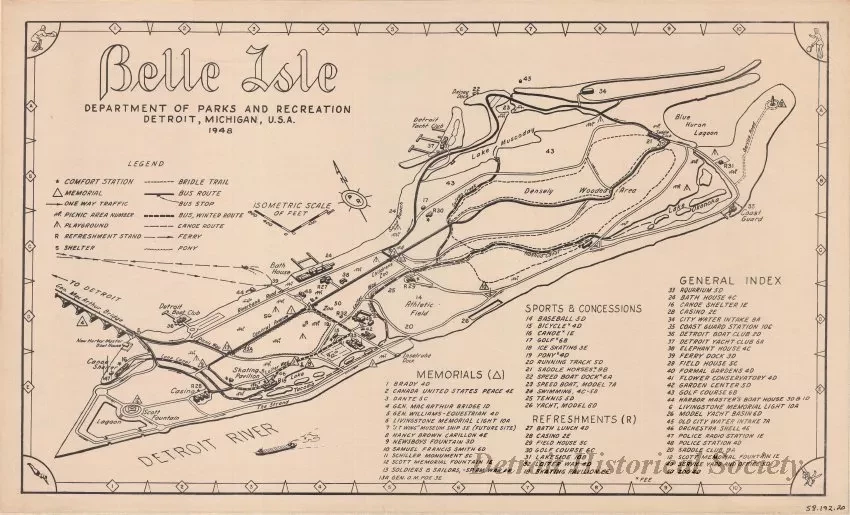
Belle Isle
One map titled "Belle Isle." The map is printed in black ink on white paper and shows an elevated view of the island. Roads, lakes, canals, and wooded areas are shown along with a detailed number key that indicates the locations of park amenities and various sites of interest. The map was prepared at a scale of 1 inch = 700 feet by the "Department of Parks and Recreation, Detroit, Michigan," and is dated 1948.
Request Image

