1968.102.004
Map
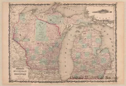
Johnson's Michigan and Wisconsin by Johnson and Ward
One map entitled "Johnson's Michigan and Wisconsin by Johnson and Ward." The map is printed in black ink on white paper and shows the state, county, and township boundary lines for Michigan and Wisconsin as well as portions of Minnesota, Illinois, and Ontario. Light red and green coloring is shown for counties and for state boundary lines. The principal meridians and base lines are also indicated for both Michigan and Wisconsin along with township and range numbers for the public land surveys of the two states. Cities, towns, lakes, and major rivers are also indicated. Lines of latitude are also shown and lines of longitude are given relative to "Washington" (Washington, D.C.). The map is drawn at a scale of 1 inch = 24 miles.
Request Image

