1991.013.020
Map
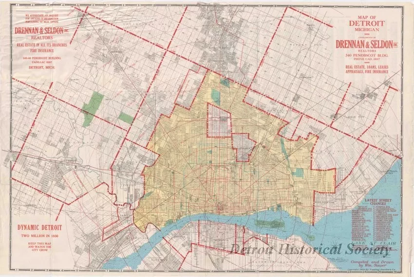
Map of Detroit, Michigan
One street map of Detroit and Eastern Wayne County that was published by the Topping-Sanders Company. The multicolor map is printed on paper at an approximate scale of 1.5 inches = 1 mile. It shows streets, street names, city and township boundaries, section numbers, railroad and streetcar lines, and recent street names changes in Detroit. Two inset advertisements in the upper corners promote the real estate company of "Drennan & Seldon, Inc." A large note in the lower left corner of the map shows "Dynamic Detroit - Two Million in 1930. Keep This Map and Watch the City Grow." The map was "compiled and drawn by Wm. Sauer."
Request Image
![Map - Topping-Sanders Company
[Map of Detroit and Eastern Wayne County]](/sites/default/files/styles/430x323_1x/public/artifact-media/178/1966135001.jpg.webp?h=01df0c50&itok=1SonEBFb)

