1957.086.010
Map
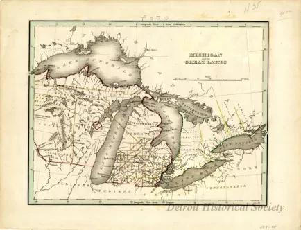
Michigan and the Great Lakes
Map titled "Michigan and the Great Lakes," representing Michigan and the Great Lakes region, including lakes, rivers, territories, and towns from 1835. Huron Territory is enclosed in a purple line. Counties in Michigan are enclosed in tan lines. Parts of Upper Canada are enclosed in a green line, with different districts separated by yellow lines. Title block and scale are located on the top right corner of the map. Lines of latitude and longitude are indicated along the perimeter of the map. Printed text along bottom right edge of map reads "G.W. Boynton & Co. Sc."
Request Image

