Map
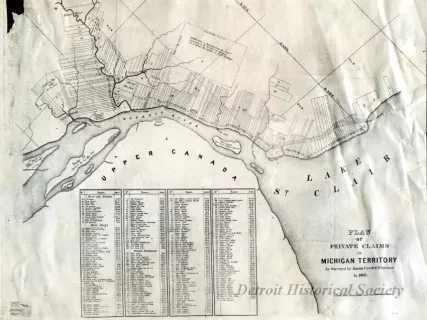
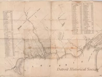
Patrick McNiff's Plan of the Settlements at Detroit, 1796
One reprint of a map entitled, "Patrick McNiff's Plan of the Settlements at Detroit, 1796." The map area extends from the mouth of the Detroit River at western end of Lake Erie up to the head of the St. Clair River at the southern end of Lake Huron. It shows details of the shoreline, islands, tributary rivers, roads, and settlements as well as the locations of land parcels, parcel numbers, and names of landowners along the American shore. Map details are drawn by hand in black ink on paper that has a white/gray background.
A note in the center right area of the map shows "A plan of the settlements at Detroit and its vicinity from River Rouge upwards to Point au Ginglet on Lake St. Clair. The breadth of the different farms taken on the 23, 24, 25, 26th of August 1796. Delineated by a scale of ten arpents or French acres to one inch - Royal Measure of Paris. The farms within that space having originally been laid out by French Measure. The remaining part of the plan laid down by a scale of 360 Gunter's chains to one inch by Patrick McNiff, Detroit, Decem'r, 1796."
Request Image


