Map
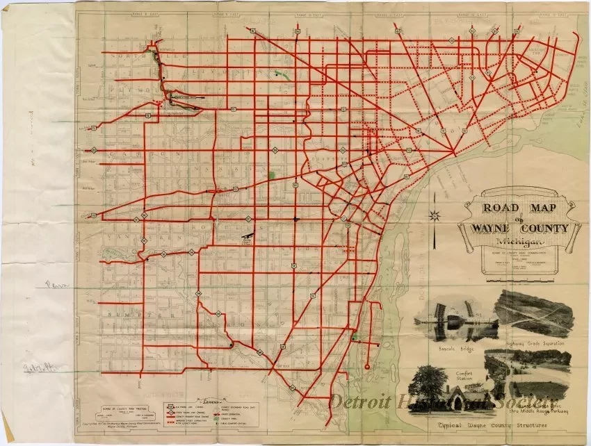
Road Map of Wayne County Michigan
Road map of Wayne County, Michigan, published by the Board of Wayne County Road Commissioners. The map is on off white paper, printed in shades of black and grey along with red for the major roads, and light green for waterways and parks. A partial hand drawn grid in green has been added to portions of the map. Half-tone photographic elements decorate the lower right portion of the map. Titled "Typical Wayne County Structures," these depict the Dix Avenue bascule bridge spanning the Rouge River, a highway grade separation, a comfort station, and Edward N. Hines Drive thru Middle Rouge Parkway. The maps lists the members of the road commission board as Michael J. O'Brien, chairman; Edward N. Hines, vice chairman; Peter M. Schoenherr, commissioner; and Leroy C. Smith, engineer-manager. The right edge of the map appears to have been trimmed off, while and additional strip of paper repurposed from a blueprint has been taped along the left edge. Along this strip are the handwritten labels "Penn" corresponding to a hand drawn green line tracing along Pennsylvania Road, and "Gibralter" corresponding to the line tracing along Gibralter Road. The verso of this strip is printed with a remnant of a plan for a metal roof.
Request Image

