2014.004.103
Map
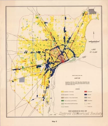
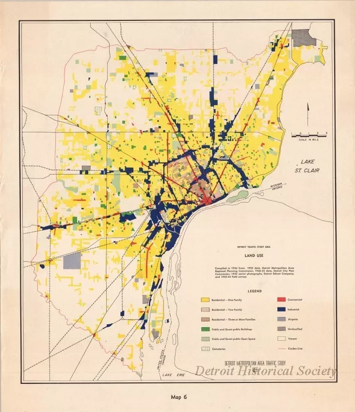
Detroit Traffic Study Area - Land Use
One map entitled "Detroit Traffic Study Area - Land Use." The multicolor map shows the major roadways in the Detroit Metropolitan region along with color-coded areas that show the various types of land use throughout the city such as residential, commercial, industrial, and public. The map was compiled from various sources and was prepared as part of the "Detroit Metropolitan Area Traffic Study." It is dated 1955.
Request Image


