2013.049.385
Map
Detroit Traffic Study Area,
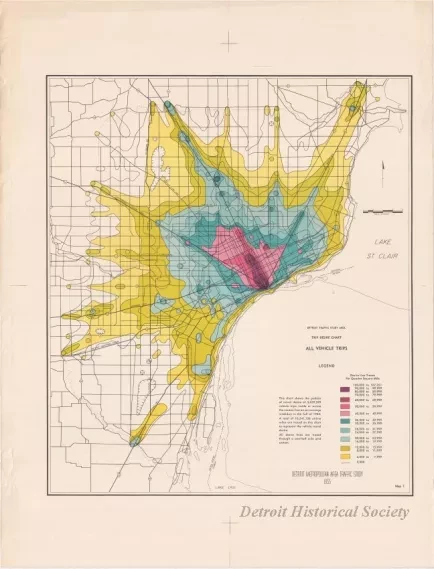
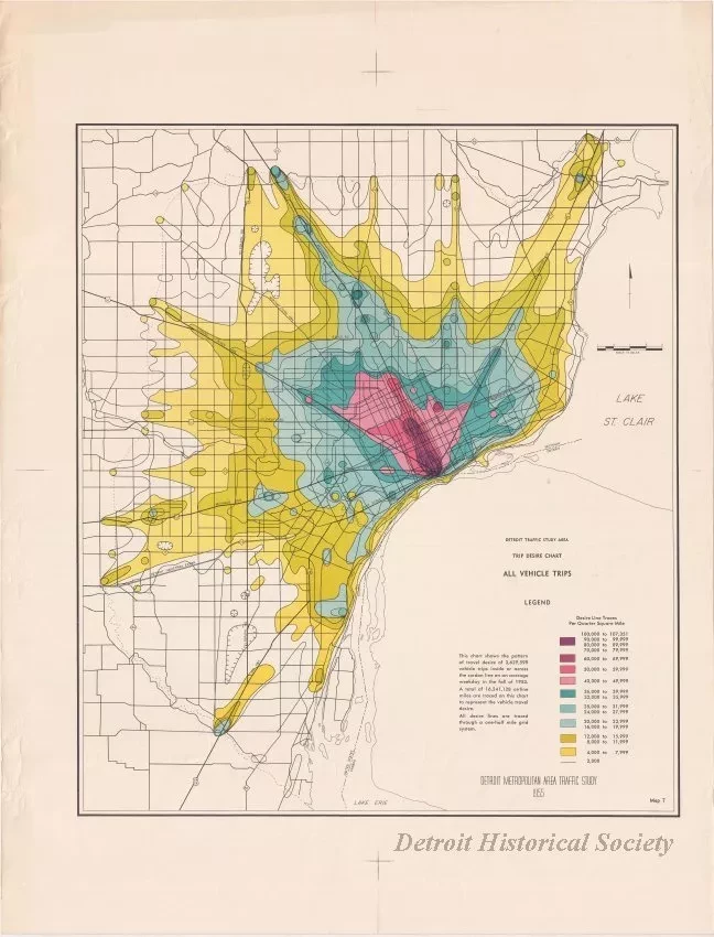
Trip Desire Chart - All Vehicle Trips
One map entitled "Detroit Traffic Study Area, Trip Desire Chart - All Vehicle Trips." The multicolor map shows the major roadways in the Detroit Metropolitan region along with color-coded areas that show the "pattern of travel desire of 3,629,599 vehicle trips inside or across the cordon line on an average weekday in the fall of 1953." The map was prepared as part of the "Detroit Metropolitan Area Traffic Study" and is dated 1955.
Request Image


